
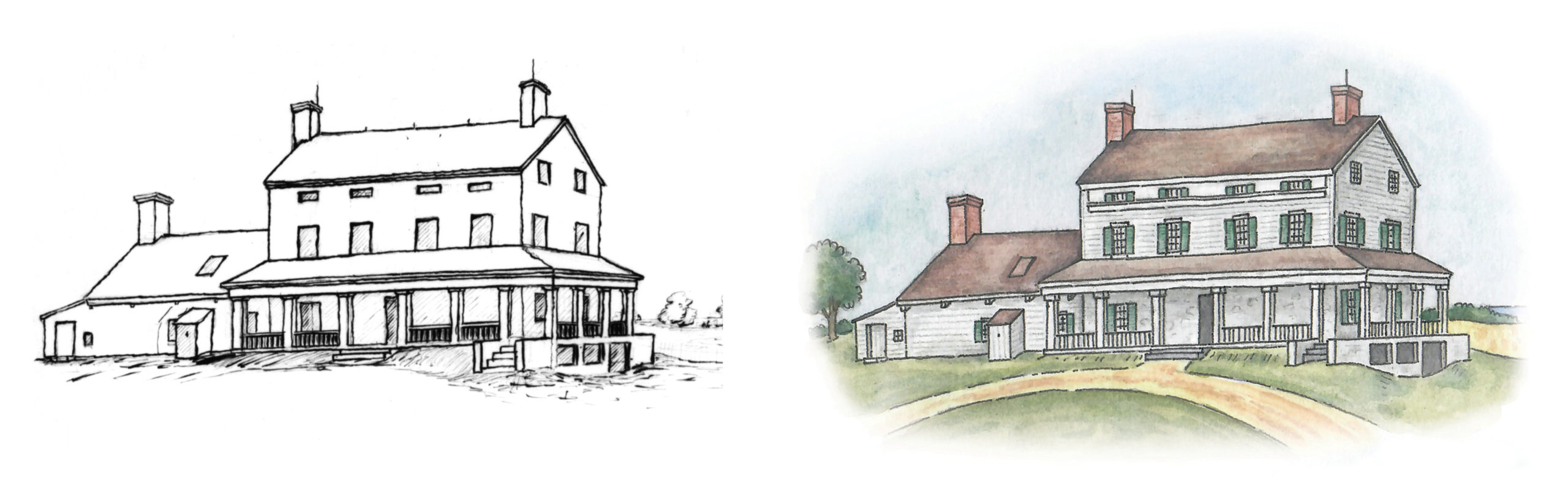
Left: Frederick Law Olmsted’s drawing of his Staten Island farmhouse circa 1849. Library of Congress.
Right: Watercolor rendering of Olmsted’s Staten Island farmhouse on the map based on Olmsted’s drawing. Giuseppe Settinieri, 2021.
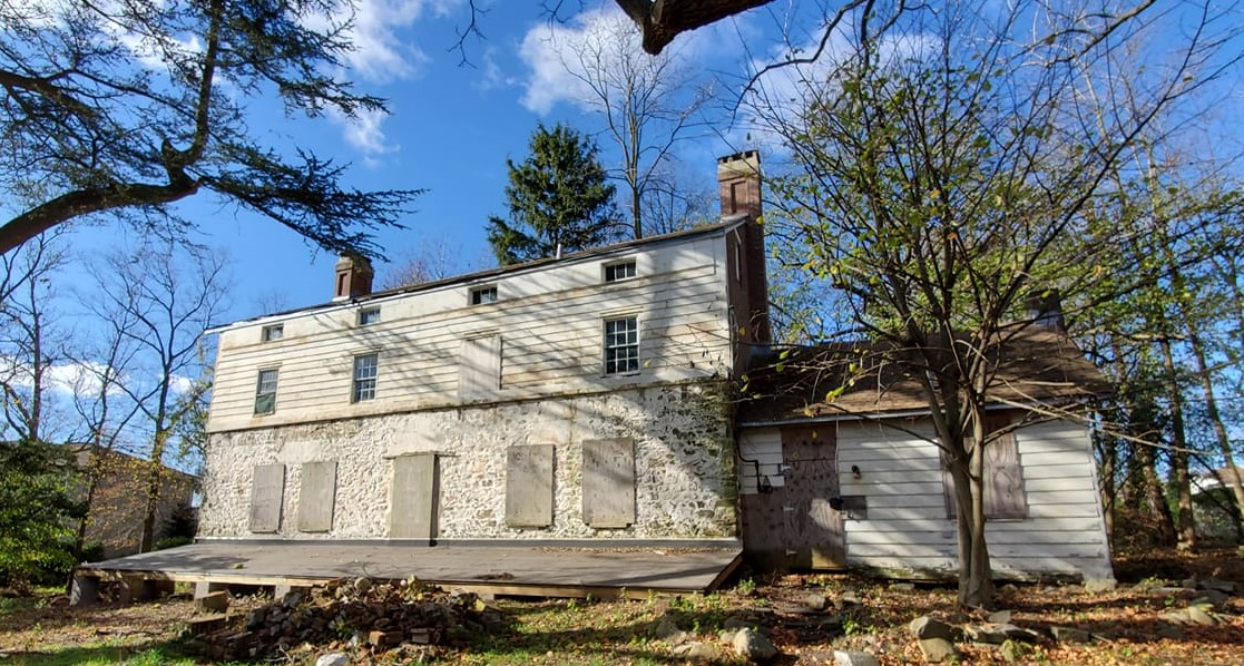
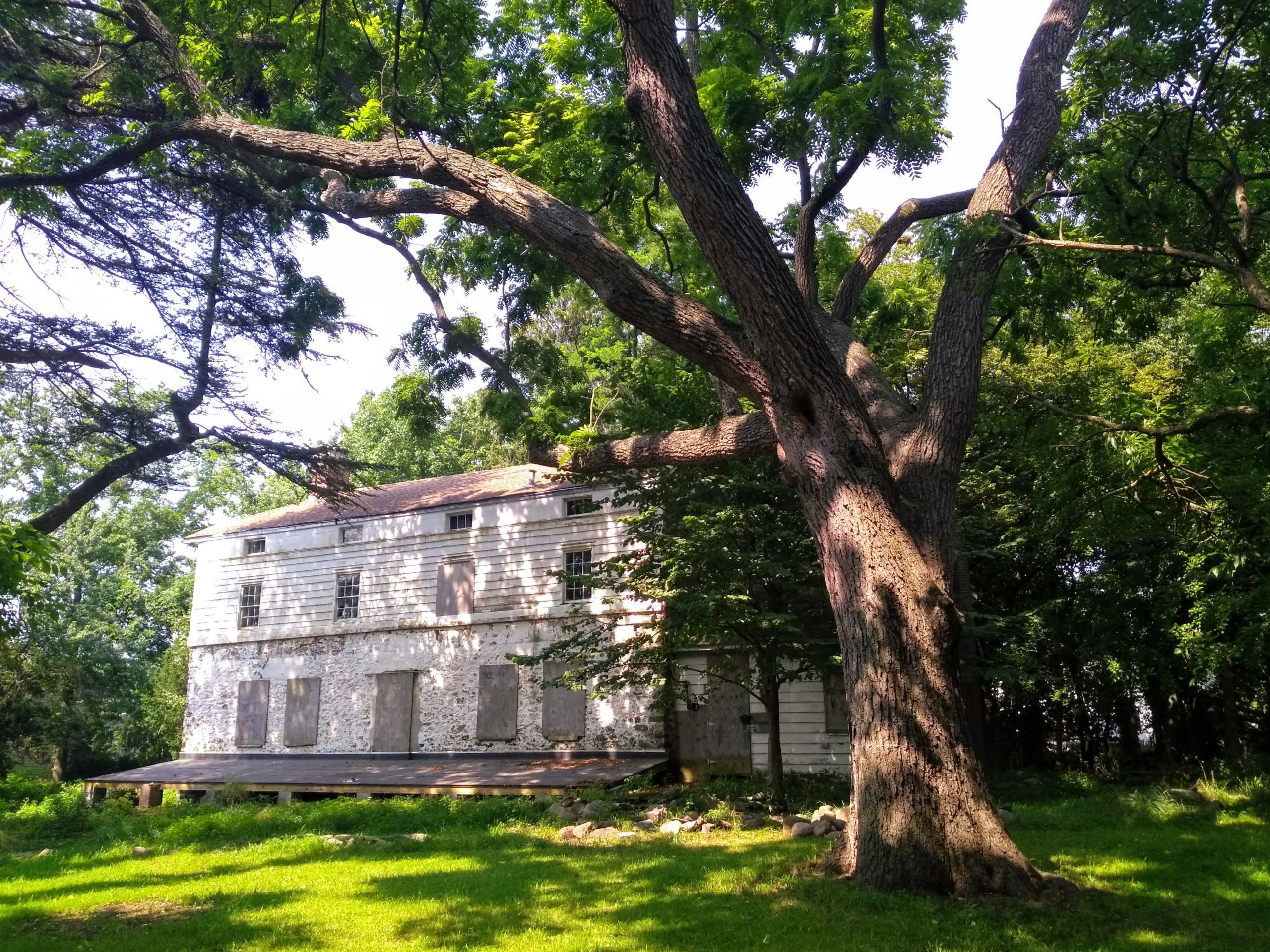
The Friends of Olmsted-Beil House (FOBH), a nonprofit organization working to preserve the 17th-century farmhouse on Staten Island, NY, where Frederick Law Olmsted lived from 1848 to 1855, is proud to present the “Frederick Law Olmsted on Staten Island Discovery Map”. This map illustrates many of the Staten Island locations associated with Olmsted. It was created through the collaborative effort of the FOBH project team that I led. The team, which provided historical insights and editorial suggestions, included FOBH President Eileen Monreale; Staten Island historian & FOBH Advisory Board member Patricia M Salmon; Staten Island historian & FOBH Board member Tina Kaasmann Dunn; FOBH Board members Felicity Beil and Maureen Marlow; and retired librarian & digital map specialist Andrew Wilson.
I am a graphic designer and illustrator, and I have always had a passion for local history and historical research. To ensure the accuracy of the map, I spent months reading Olmsted’s writings, including the letters, books, and articles he wrote while living on Staten Island. In so doing, I learned all sorts of delightful details like the names of his farm animals and pets, including his black Newfoundland dog Neptune, his cat Minnie, and horses called Old Black and Kate. I also consulted many historic maps of Staten Island.
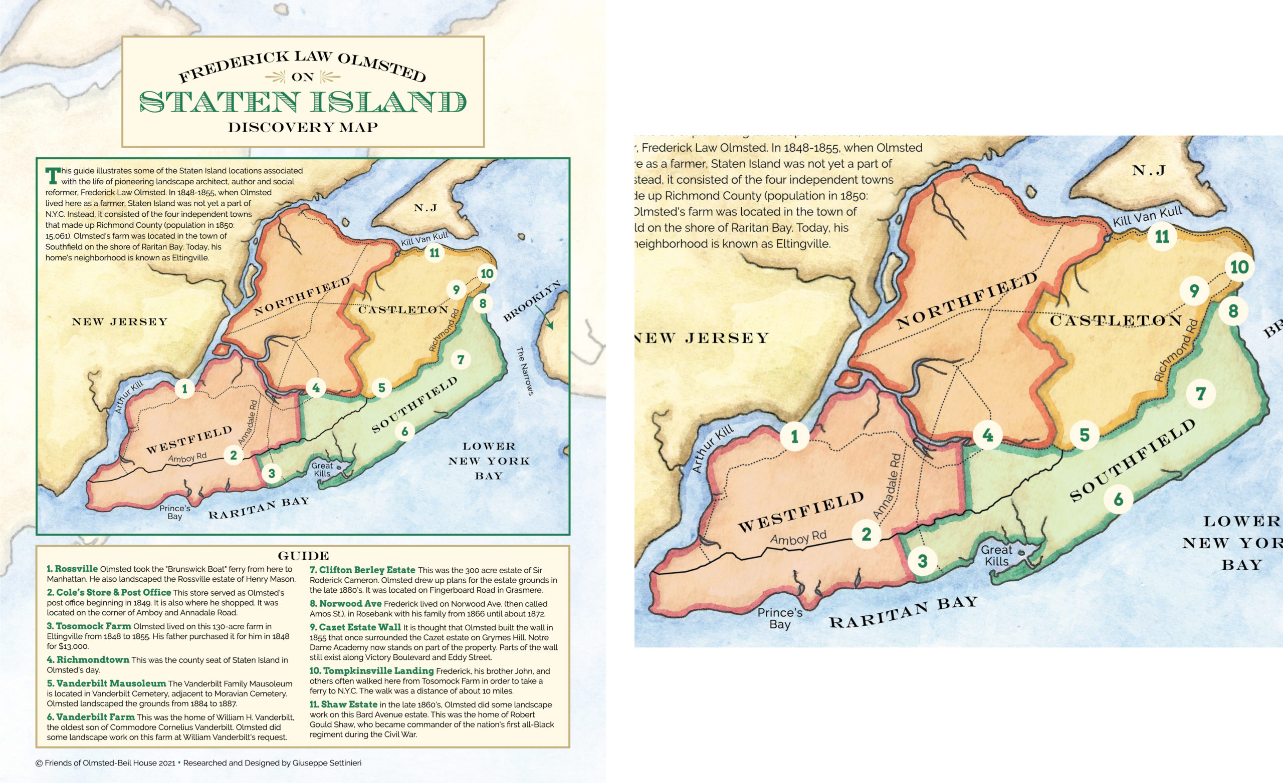
Left: Front cover of the “Frederick Law Olmsted On Staten Island Discovery Map,” with watercolor map showing Staten Island in 1850.
Right: Detail of Staten Island in 1850 map.
The Discovery Map is composed of three parts. The first is a map of Staten Island, circa 1850, copied from a map of the same period. I illustrated this map with watercolors. On it are the places Olmsted landscaped, the ferry routes he took to Manhattan and Brooklyn, the places he lived (he lived on Staten Island twice), and even where he shopped. Much of the information on this map was taken from Olmsted’s letters. For example, I learned from one of the letters that in 1849, the post office that he frequented was located at Cole’s Store, near his farm. The location of the store was confirmed in 1853 and 1860 maps.
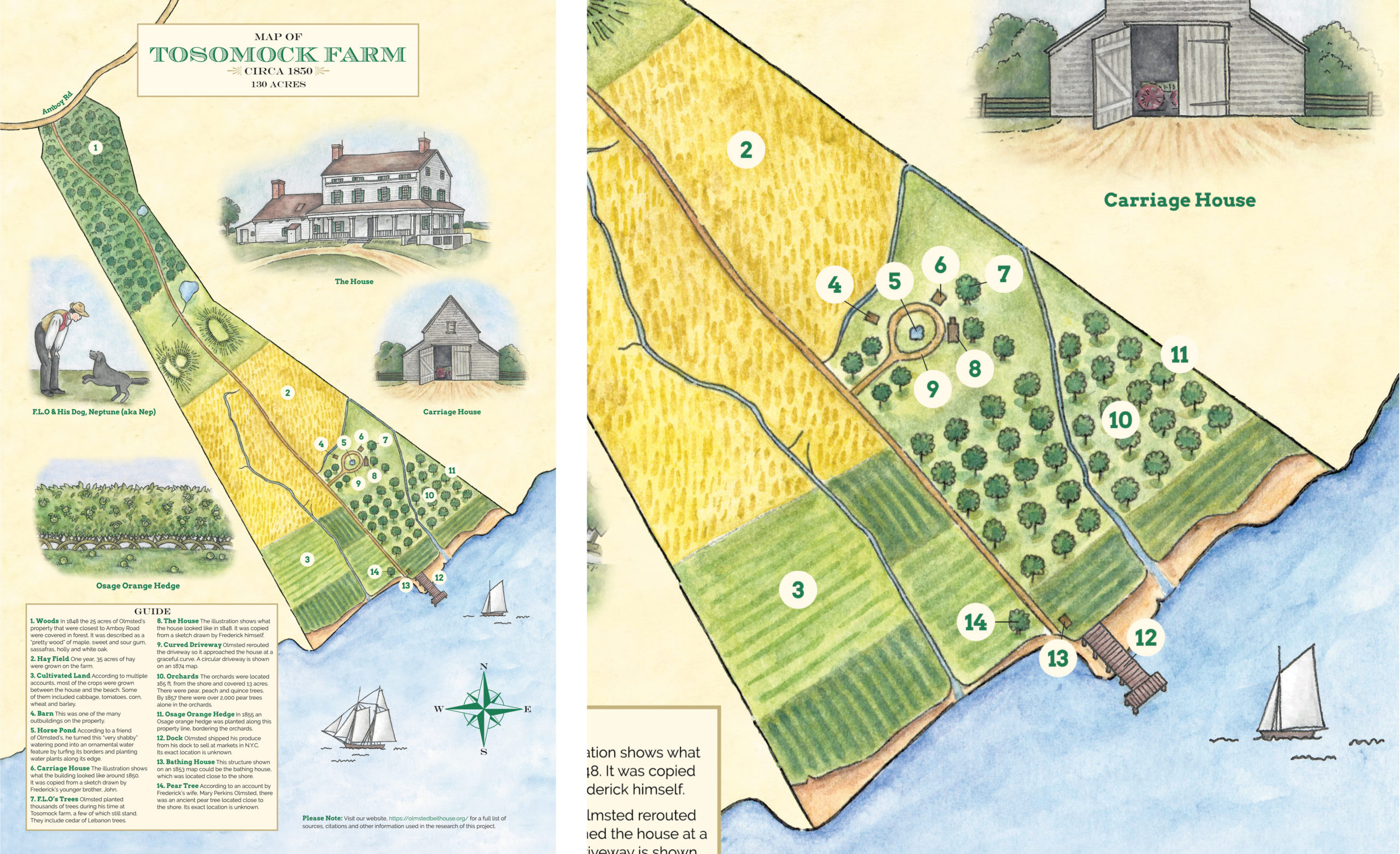
Left: Inside spread with watercolor rendering of Olmsted’s Staten Island farm in 1850.
Right: Detail of rendering showing the orchards and fields on the property.
The second part is a watercolor rendering of Tosomock Farm, the 130-acre farm where Olmsted lived from 1848 to 1855 and where his talent for landscape design was discovered. Two of the maps that I used as sources to create this rendering were an 1874 atlas and a 1913 topographic map showing the hills, streams, and ponds that were originally on the property. I gleaned information about the location of the crops, orchards, and woods and the number of acres they covered from Olmsted’s letters. I used this information along with an online tool that measures acreage to depict the area covered by the property’s features to scale.
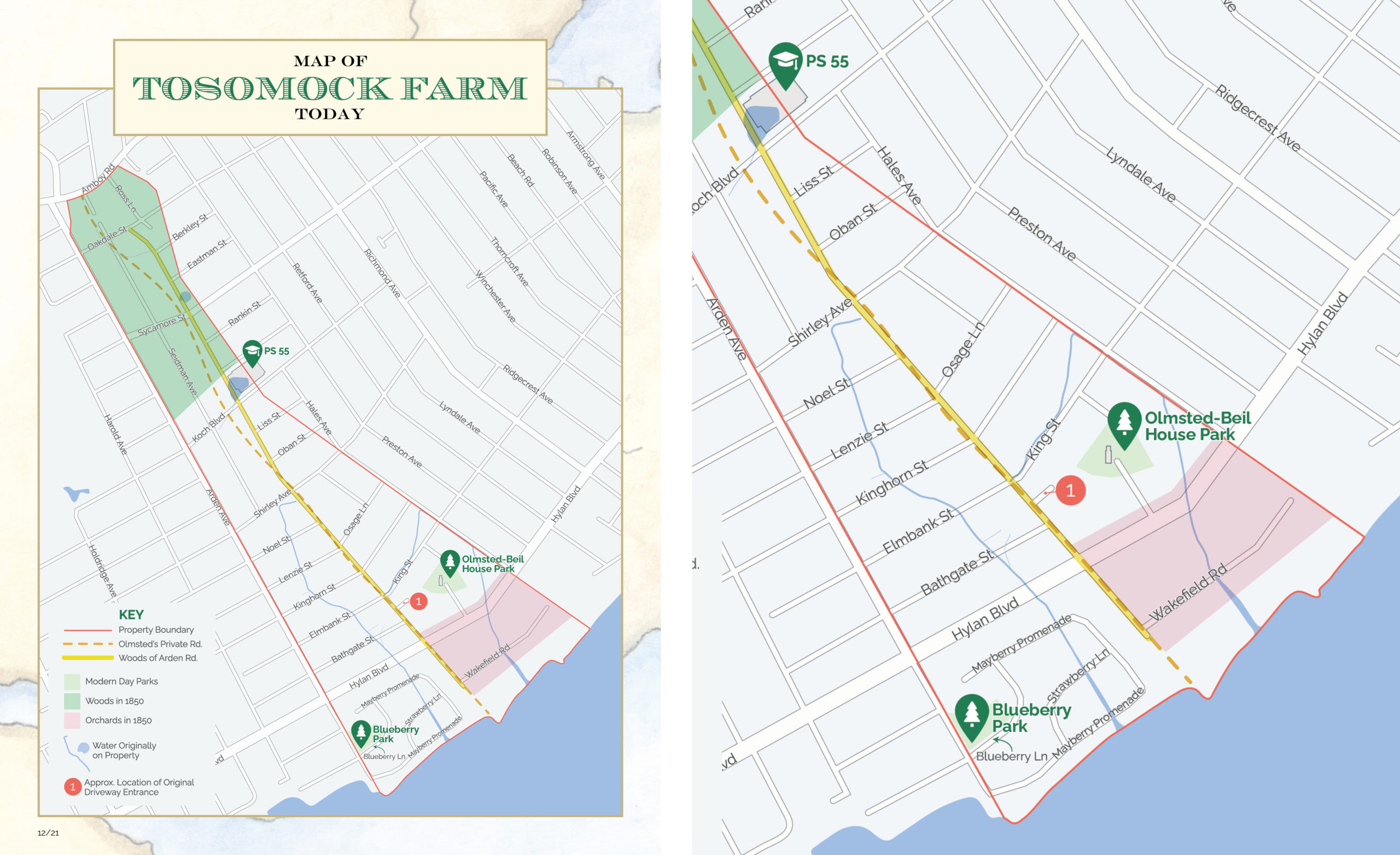
Left: Back cover with a map of the farm today.
Right: Detail of the map with Olmsted-Beil House Park near the center of the image.
The third part of the map shows the streets that currently occupy Olmsted’s original farm property as well as the location of some of the original property features, including ponds and streams, in relation to the current landscape. To achieve this image, I layered and matched historic maps of the property over a current-day map. This revealed many interesting things, including the fact that there was once a pond where part of a public school stands today.
The original farm property has been almost fully developed. However, Olmsted’s 17th-century farmhouse still stands, along with some of the trees he planted. We hope that this map brings Olmsted’s Staten Island to life and encourages you to learn more about his time at Tosomock Farm, which played a crucial role in his development as a landscape architect.
The Discovery Map can be viewed and purchased on the FOBH website: https://olmstedbeilhouse.org/discovery-map-2/. The sources that were used to create the map can also be viewed on the website in the Source Guide.
Giuseppe Settinieri is a member of the Friends of Olmsted-Beil House Advisory Board.